Routeburn Track - 'A Great (Rainy) Walk'
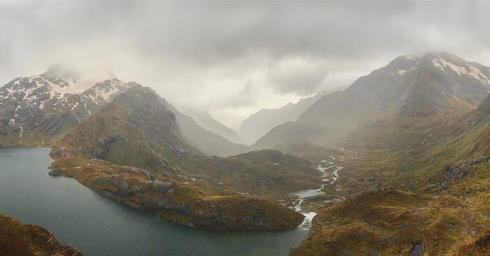
There are nine recognized multi-day backpacking trips through some of New Zealand’s most scenic and diverse landscapes that have been dubbed the “Great Walks”. They require planning well in advance as they book up quickly and are pretty expensive for non-natives. You can stay in a hut or at a campsite during your trek; the campsite obviously being cheaper, but still more than we’ve ever paid to camp! We signed up for the Routeburn Track back in the States and had been greatly looking forward to it. This track is 20.5 miles with 5,300 ft of gain, usually done in three days/two nights and is a point-to-point trail going through Mt Aspiring National Park and Fiordland National Park.
As our departure date approached, we were checking the trail status and it was concerning, to say the least. Due to alpine conditions (too much snow and avalanche hazards) the trail was closed and not predicted to reopen until after our scheduled return. We went to the Queenstown Department of Conservation Center (DOC) and luckily a really helpful employee helped us to reschedule our trip. Routeburn is one of the more popular treks, so unfortunately both the campsites and the huts were booked up until mid-January, aside from two spots on sequential nights, leaving in just a few days - the first night’s availability being a campsite and the second being in a hut. Originally we were going to camp both nights, but we went for the upgrade so that we could fit the track in before we started working. The extra $100 for the hut turned out to be 100% worth it…
Since our new reservation was only a few days out, we were still a bit nervous about the closures. As it turns out, that’s not what we should have been worried about - the trail opened two days before we left. Instead, our new concern was the forecast - a torrential downpour and gale force winds for the first two days of hiking. Oh well, nothing we could do aside from hope for the best and pack our backpack rain covers.
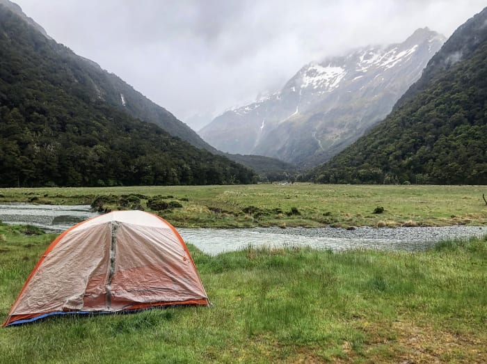
After a beautiful 1.5 hour long bus ride out to Mt Aspiring National Park, we started the trail. The first day of hiking was pretty easy; it was only a few miles out to the campsite, and luckily the rain held off while we were hiking. We got to the campsite at about 3pm, and it was incredibly picturesque, despite the clouds looming over the mountains. We got our tent set up and joined a few other campers in the small 3-walled shelter that the campers were allowed to use (the DOC is very strict about campers sticking to the facilities they paid for). And then came the rain…and it didn’t stop for 36 hours!
We spent the evening huddled on a bench in all of our layers chatting with some fellow campers. There were two other couples in our enclosure and we all bonded over our distaste for the dehydrated meals here. See, we weren’t being dramatic in the last post! One of the couples also had been living in San Francisco for the past few years, but are leaving as well. A story we’ve now heard a few times! The DOC had suggested to this couple to start the second day’s hike early so that we’d cross the hardest part during milder weather. They were planning to wake up at 5am to hit the trail by 6am. We and the third couple hadn’t heard that from the DOC, but definitely didn’t want to suffer more than necessary, so we planned for the early wake up too. We all went to bed early, praying our tents wouldn’t leak as the rain continued pouring down.
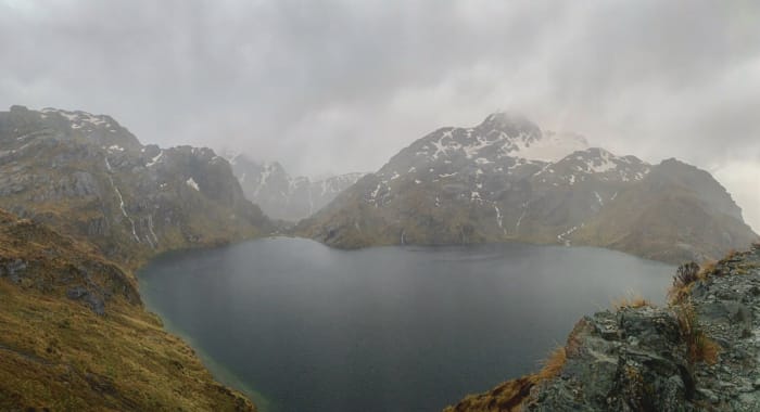
The next morning, we woke up at 5am as planned (still raining) and packed up our soaking wet tent. The first portion of the hike was about an hour up to the Routeburn Falls Hut, the cozy place where everyone else besides us crazy ten or so campers stayed for the first night! An impressive cascade, the Routeburn Falls, was right past the hut, and from there we began some uphill hiking. Due to the large amount of rain, it turns out we were essentially hiking up a waterfall at this point. There was no way to avoid getting splashed by the rushing water, so our boots were soaked through in no time. The trail evened out, so we were no longer hiking up a waterfall; instead, just hiking through a river! There was heavy brush on both sides of the trail, so there was really no avoiding the flooding. During this portion, the views, despite the clouds, were stunning. We were in a valley surrounded by tall, moody mountains and golden vegetation. The steady uphill began again, but we quickly made our way up to a beautiful vista point with views of the valley we had just tramped through, the mountains, and an alpine lake, Lake Harris; the sun even momentarily poked out here!
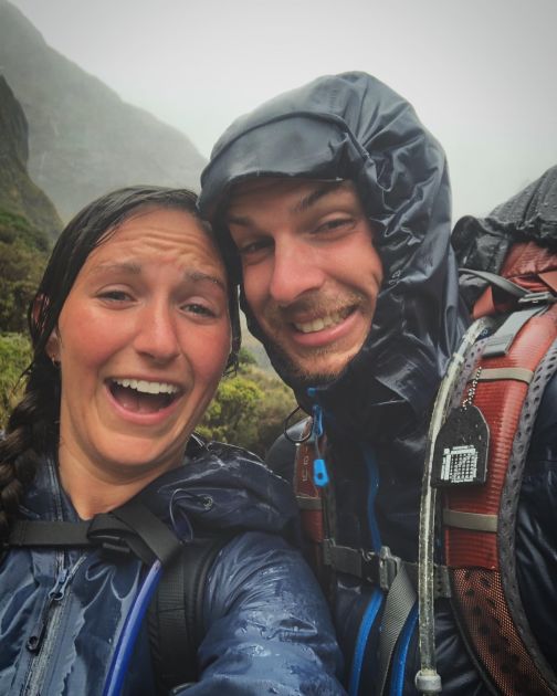
From there, we followed the lake for a bit and then made it to a shelter that marked the beginning of the Harris Saddle. This would be the toughest part in the bad weather as it is totally exposed to the wind and rain, and marks the beginning of our climb to the highest elevation. Throughout the saddle, both the rain and wind had picked up, and since we were at a higher elevation, we were both pretty cold. Looming clouds and fog obstructed the visibility during this portion, but we know from pictures that the Darran Mountains were sitting there behind it all! Eventually, we made it through the saddle without getting blown off the narrow trail, and started the descent down to Lake Mackenzie. Tall, granite walls with gushing waterfalls made for a beautiful backdrop. There were more waterfalls than we could count, all flowing heavily, making for a very impressive weeping wall - one perk of hiking during a rainstorm! We could never decide if it was worth stopping to take a picture or continuing on to our dry hut for the night.
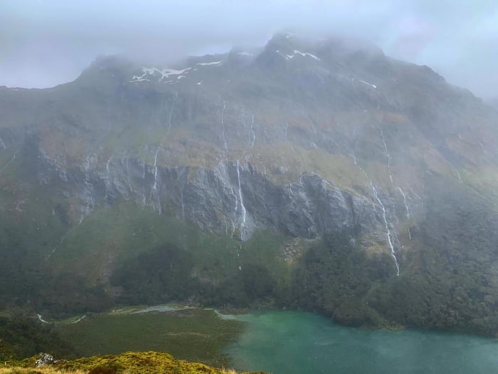 One of the places we pulled out the camera, the lense got a bit wet…
A bit before noon, the Lake Mackenzie Hut came into view, but the easy track to it was flooded, so we had to take a less defined flood detour to the hut. Eventually though, we made it to the hut - the first ones there! We went to claim our bunks, and to our dismay, as we were unpacking, we realized our backpacks had soaked through and although nothing was drenched, EVERYTHING was damp, including our sleeping bags and the clothes we needed to change into. There was really no way around it, so we peeled off our soaking wet hiking clothes and changed into some slightly drier ones. The hut had no heating and the warden had yet to start a fire, so the new clothes didn’t provide us with much relief.
Since we arrived to the hut so early, we had a ton of time to kill - we spent the afternoon and evening napping, cooking, playing cards, and did a ton of reading while huddling together in our sleeping bags to try to warm up. The clothes that we were wearing eventually dried out, as did our sleeping bags in time for bed. We couldn’t imagine having to camp again that night - not only was our tent still soaking from the night before, but all of our clothes and gear were now as well. At least in the hut, we had a bunk bed and shelf to hang all of our stuff from and hope it dried out, and more importantly, a dry place to sleep. We were told by the other San Francisco couple (who stopped in the hut before getting kicked out as they only had a campsite reservation) that this campsite’s shelter didn’t even have walls to block the wind. They arrived shortly after us, so we have no idea how they spent their whole evening (but hope they stayed warm and as dry as possible). The other couple from the night prior ended up talking to the hut warden and switching their campsite reservation to a spot in the hut. As we heard the pouring rain pounding against the roof all afternoon, evening, and night, we were infinitely grateful that our rescheduled trip only had hut availability for this night.
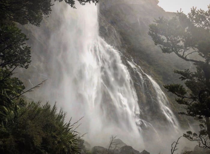
The next morning, we woke up at 5am again in hopes of catching the early bus back to Queenstown. Our gear had unfortunately not dried out completely so we put on some damp clothes and stepped into our boots that sloshed with moisture as we laced them up. This time, we put our “dry” clothes in a produce bag hoping that would keep them dry, so that we could change at the end of the trail. As it turned out, we didn’t even need to do that - it didn’t rain at all during this portion! The highlight of this last section was Earland Falls, an absolutely enormous waterfall made even more impressive by all of the rainfall the area had received. The falls covered a whole granite wall, top to bottom, and were positively raging. We immediately got sprayed as we stepped out of the forest into view of it; it was so powerful that we couldn’t even get too close without getting knocked over by its wind and spray, making it no surprise that we had to take the flood detour to pass.
We completed the 7.5 miles by 9am and waited at the bus stop, crossing our fingers that there’d be room on the early bus. Our original tickets were for 3:15pm, but with a four hour ride ahead of us to get back to Queenstown and our legs feeling good, we decided to try for the early bus (it was either the 10:15am or wait till 3:15pm). Luckily there were two spots on the 10:15am (just two though - we were lucky!), so we were back to Queenstown by 2:30pm, our clothes in our hostel’s washing machine by 3pm, our tent air drying on the clothesline by 3:05pm, and us napping in dry clothes under a warm blanket by 3:10pm.
For more pictures, check out our Instagram, from_oakland_to_auckland, also linked below!
